
Hiking the Jagged Peaks Trail & Camping on Saryang Island
/
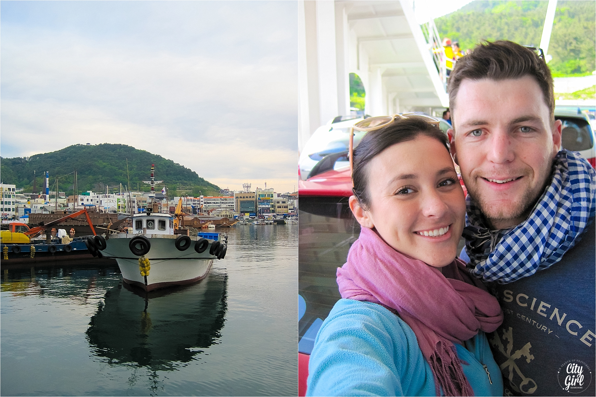
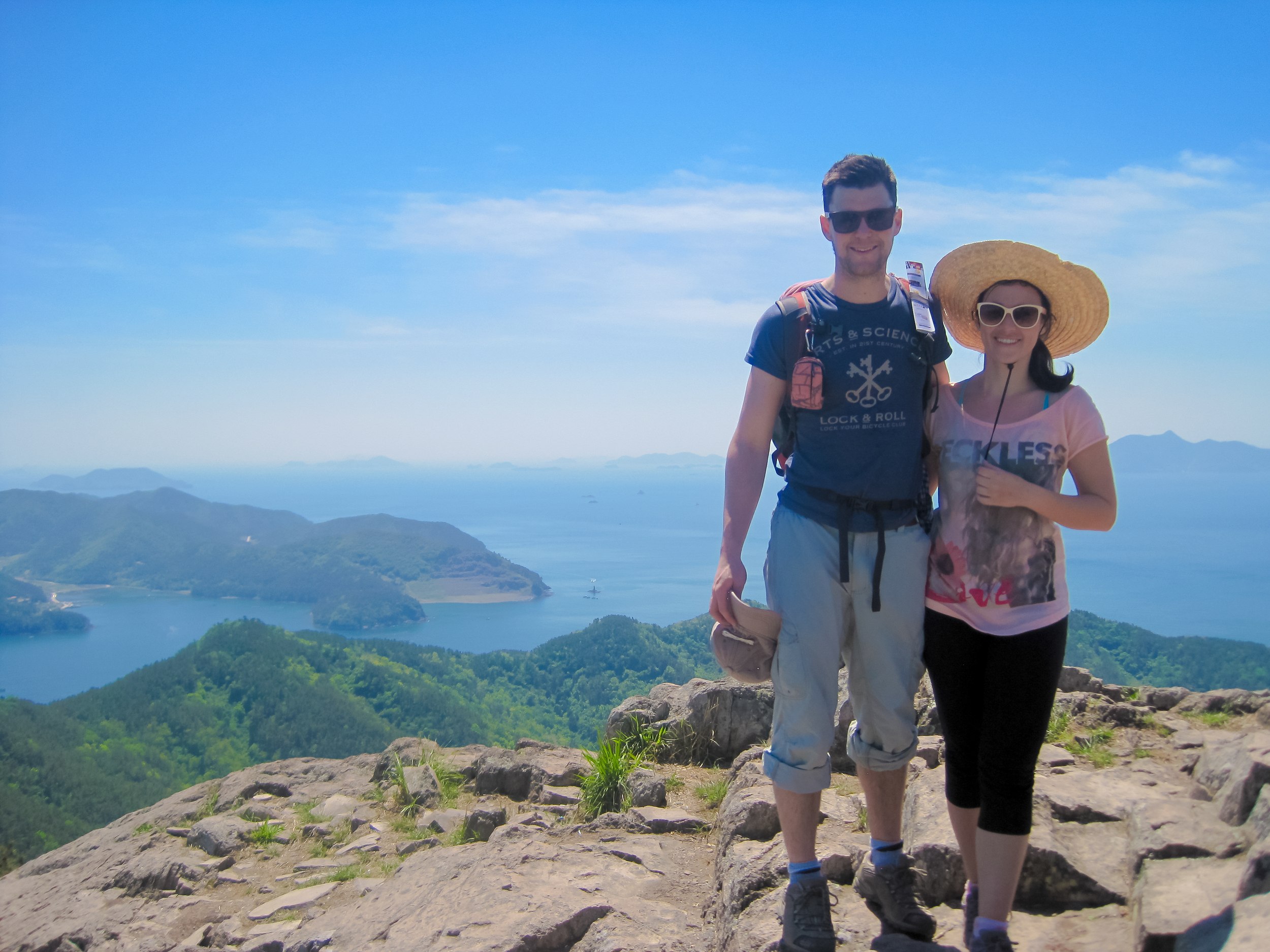
At the change of the season, Farmboy and I, along with a bunch of friends decided to head to Saryang Island to hike the Jagged Peaks trail. We didn't know much about the hike, but we did know that summer was approaching and soon we would be unable to walk a few metres without being out of breath from the humidity. So we decided to make hay while the sun was shining and packed our camping gear for the long weekend in April.
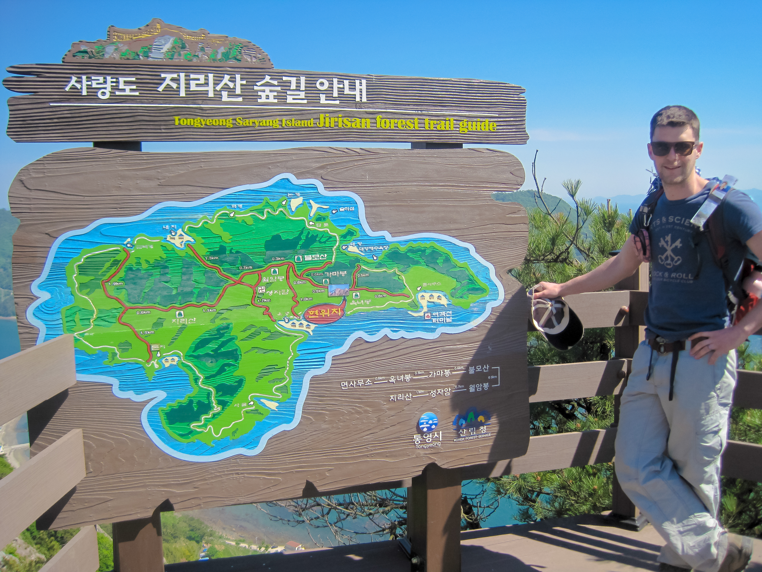
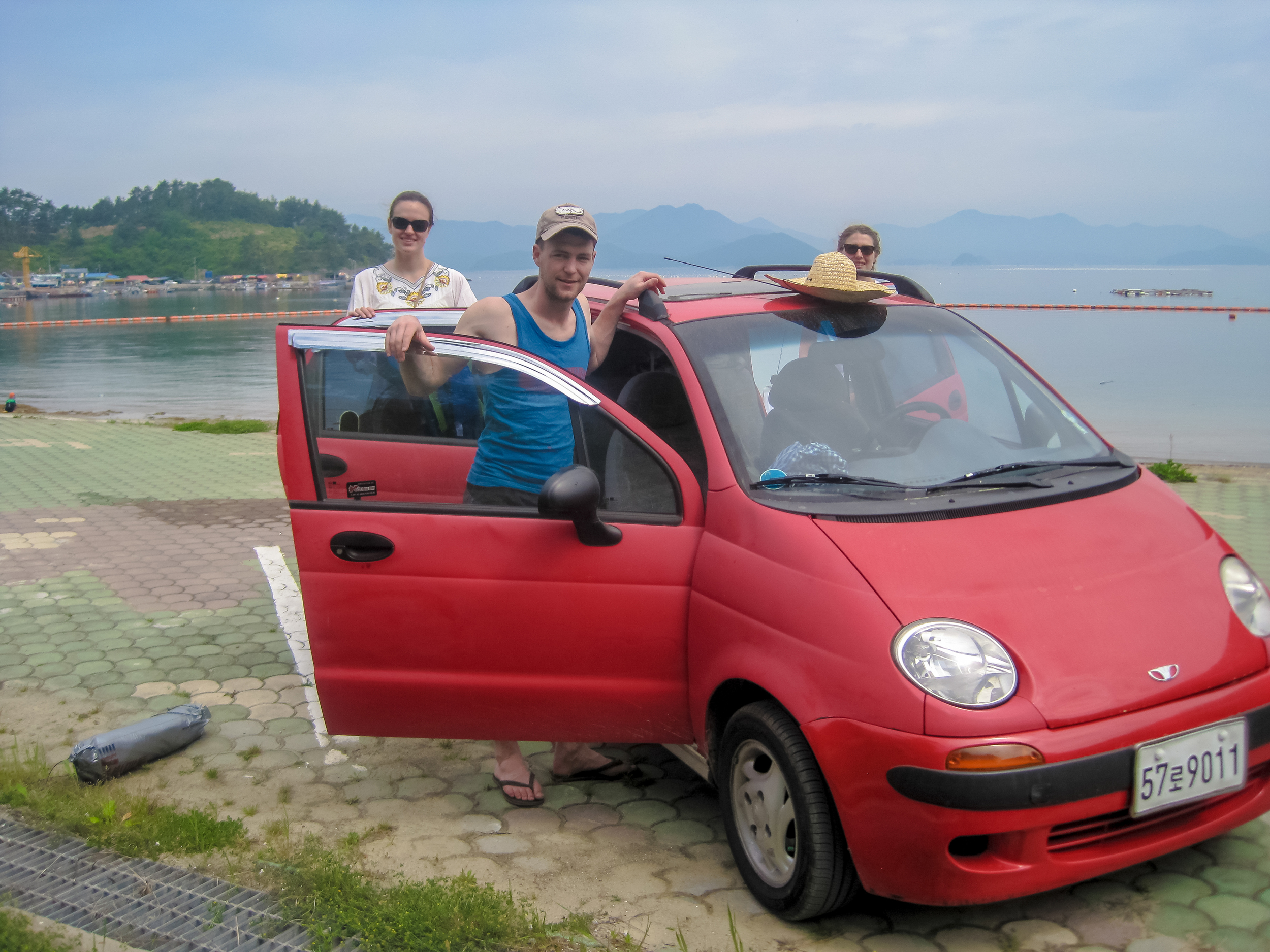
Saryang-do ("do" means Island in Korean) is a small island just off the coast from Tongyeong. Farmboy and I were testing out Cherry (our beat up but-still-going-strong red car that we had recently bought) and drove from Buan to Tongyeong in about 4 hours. Saryang-do is the red dot on the map below:

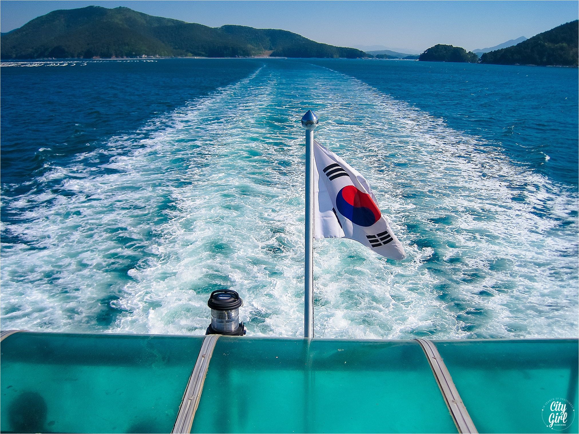
From Tongyeong, you have to catch a small ferry to Saryang-do (be warned, there are 3 ferry terminals in Tongyeong) and the first ferry for the island was at 7am. We stayed at a jimjilbang (possibly the worst idea we could have had) but it was cheap and did mean we were relatively close to the ferry terminal. The quickest ferry leaves from Saryangdo Passenger Boat Terminal (사량도여객선터미널) at Gauchi Harbour 가우치항, 15km north west of Tongyeong city centre so budget your time accordingly! We missed the first ferry but were able to make second one.
The ferry from Gauchi Harbour leaves at 7am, 9am, 11am, 1pm, 3pm and 5pm and takes 45mins to an hour. Tickets were W5 500 per person and around W11 000 for our small car each way.
Thanks to KoreanTrails.org here is some information on the bus route to get to Gauchi Harbour from Tongyeong city centre:
"Bus 607 runs from Lotte Mart in Tongyeong out to Gauchi Harbour.
Buses leave Lotte Mart at 6am, 8:05, 10:05, 12:05, 14:00, 16:00 and take 45-50mins.
Bus 607 starts its route at Seoho Market 20mins earlier, with the exception of the 6am bus, which starts at Lotte" KoreanTrails.
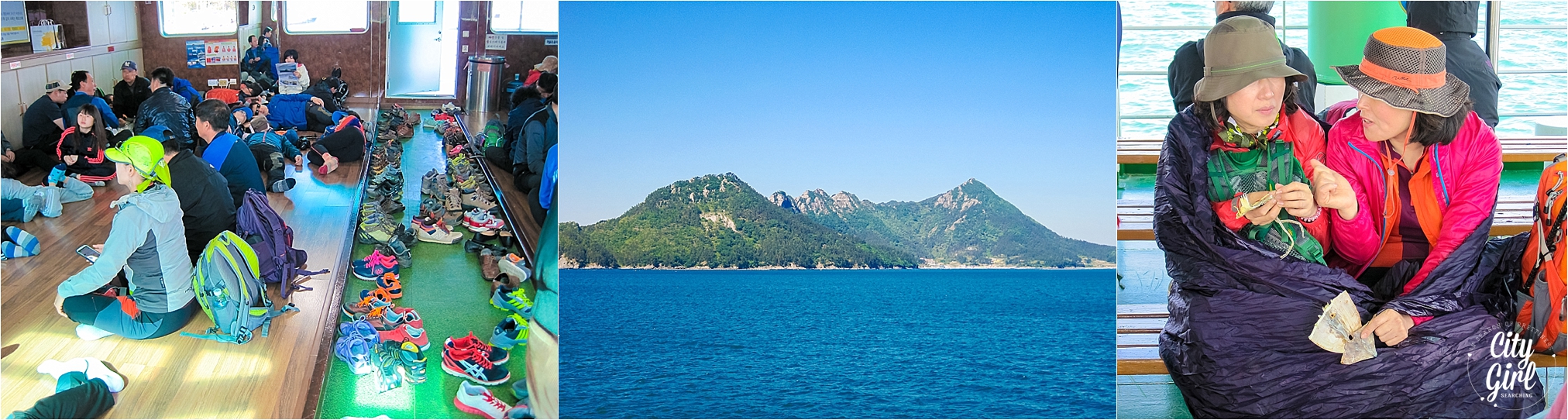
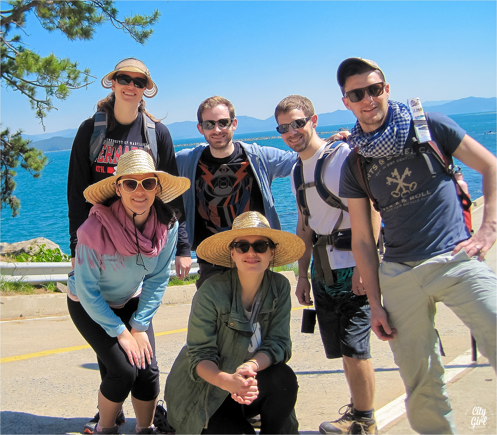
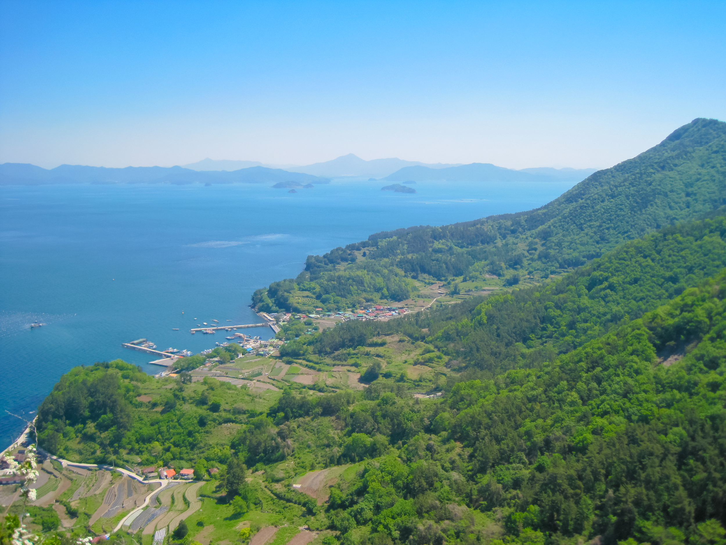
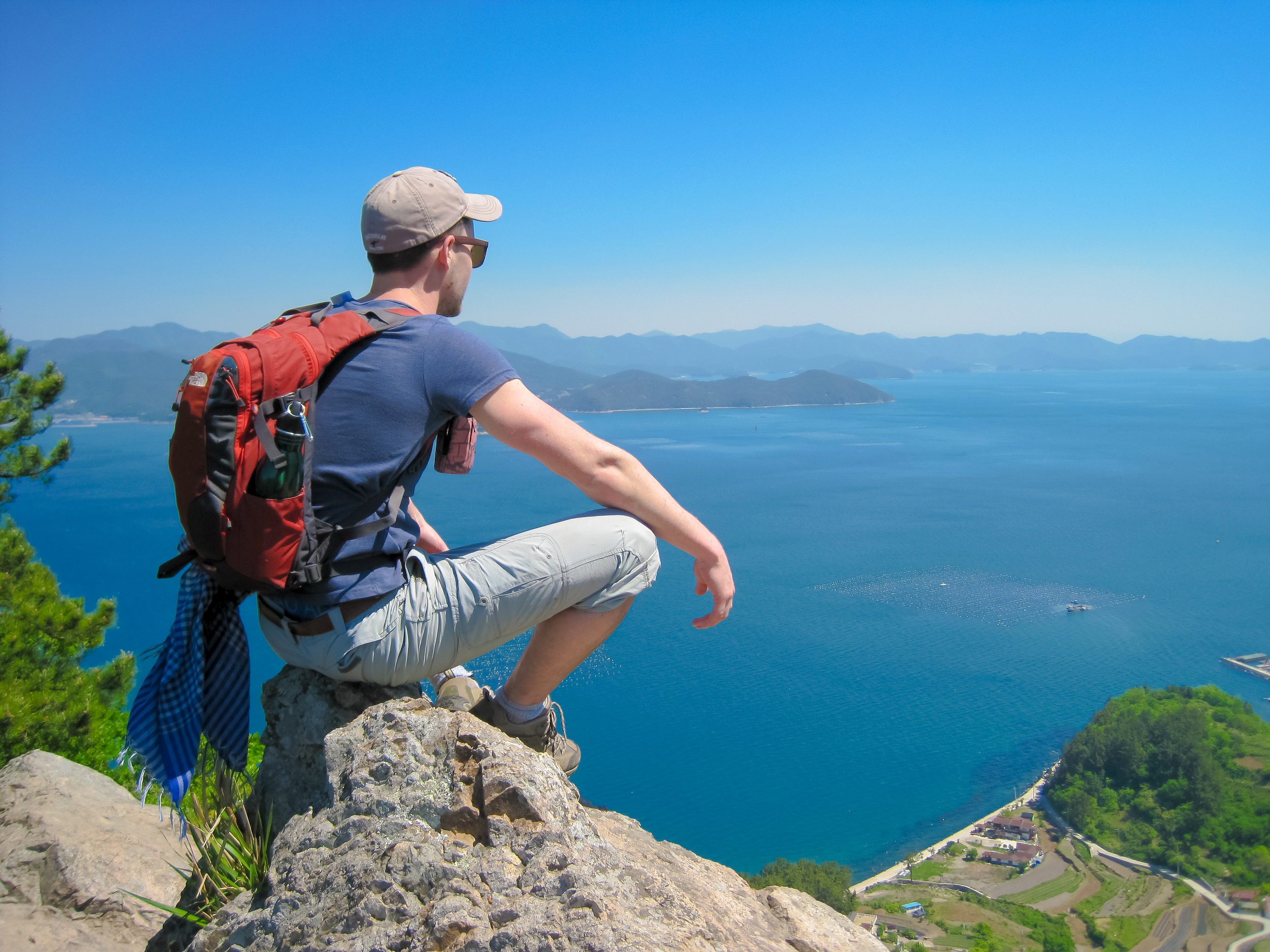
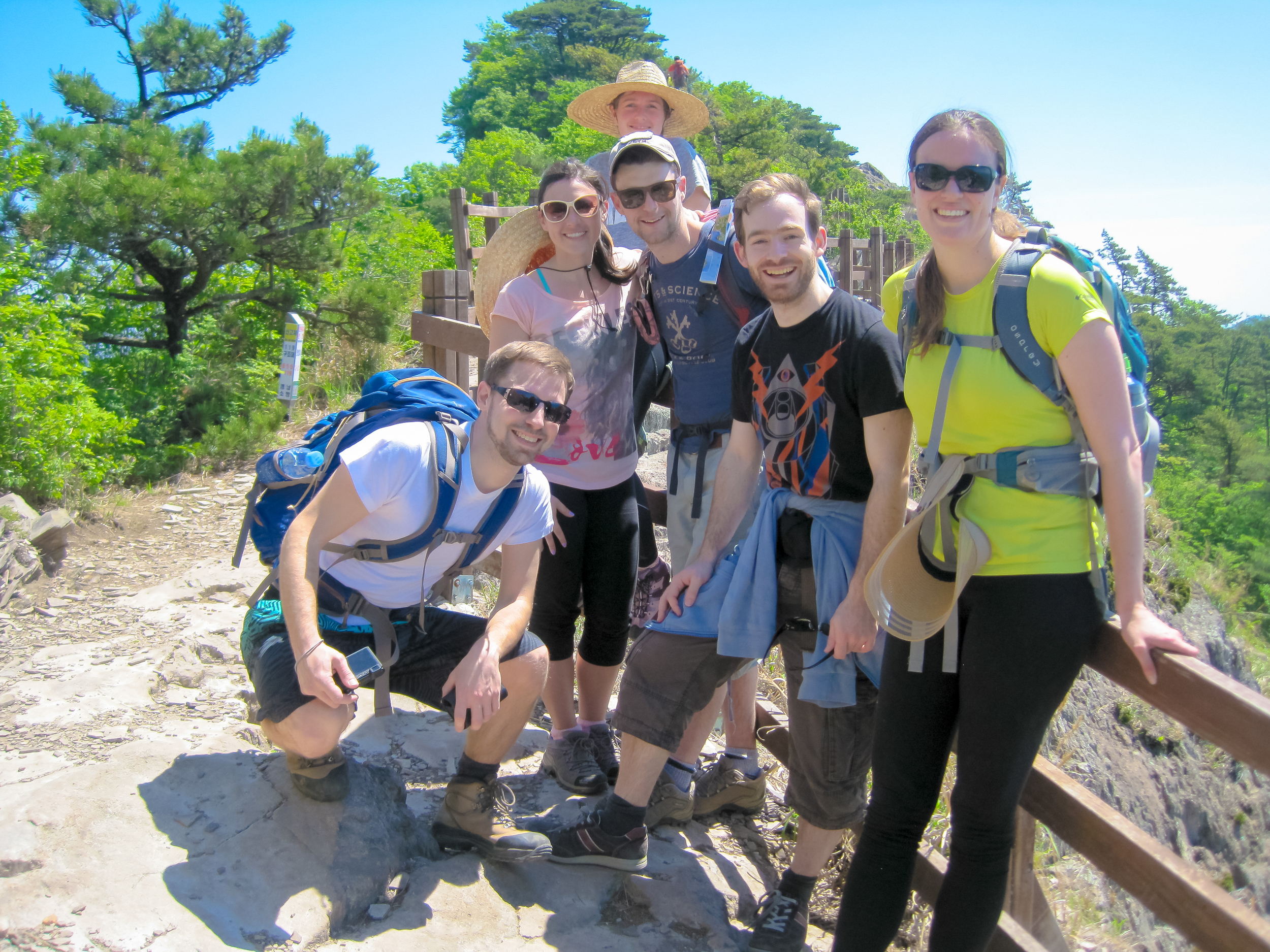
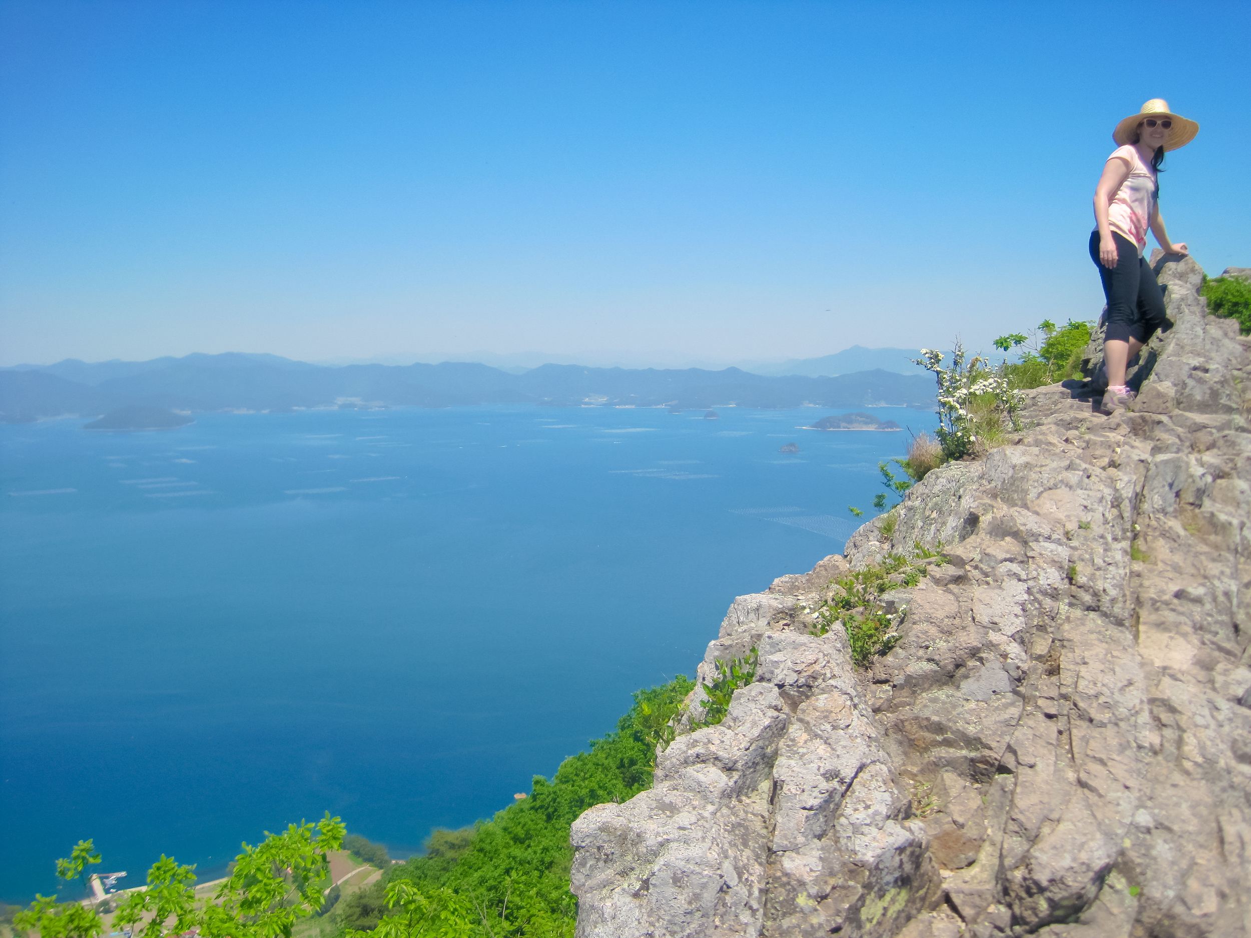
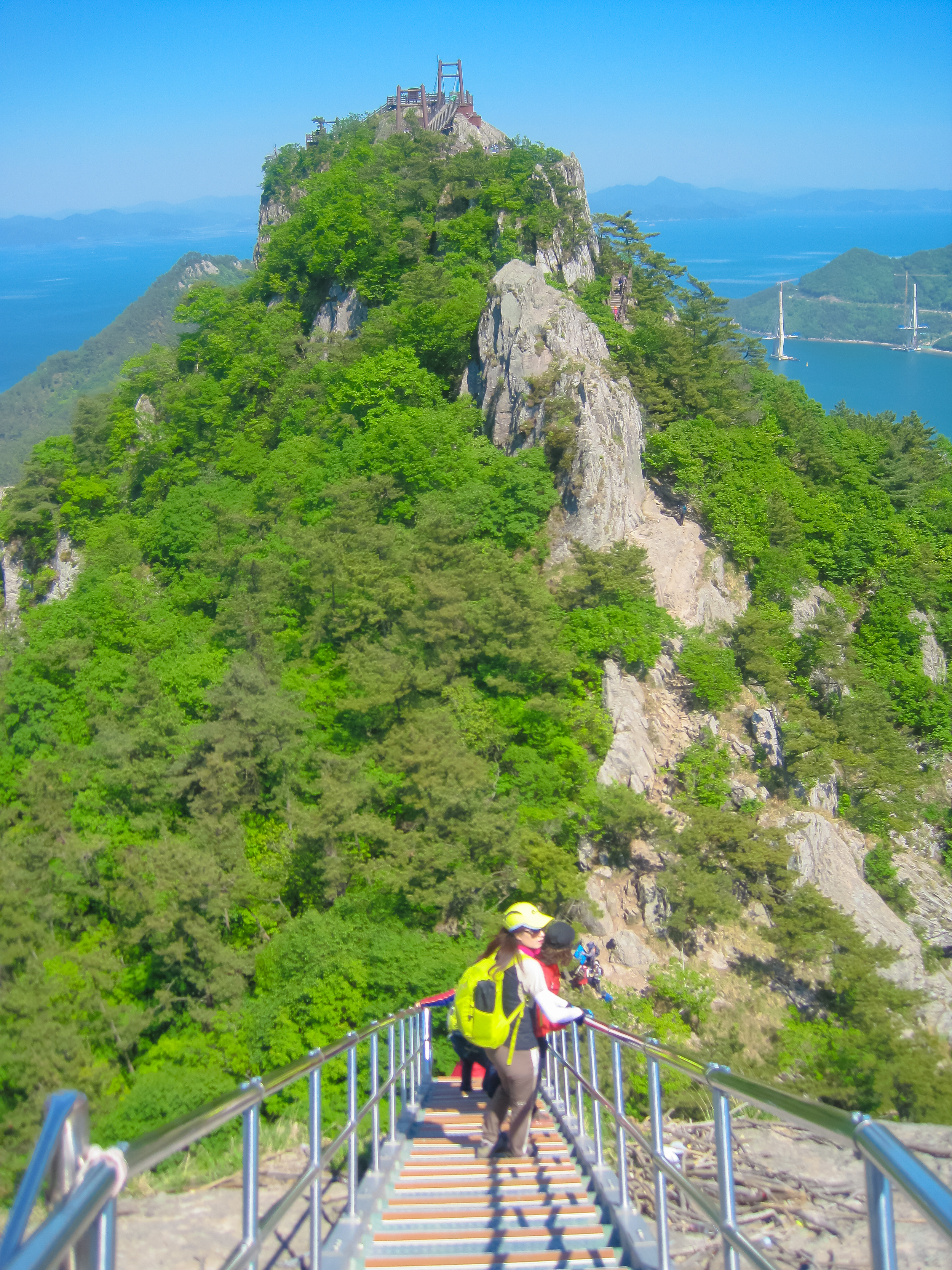
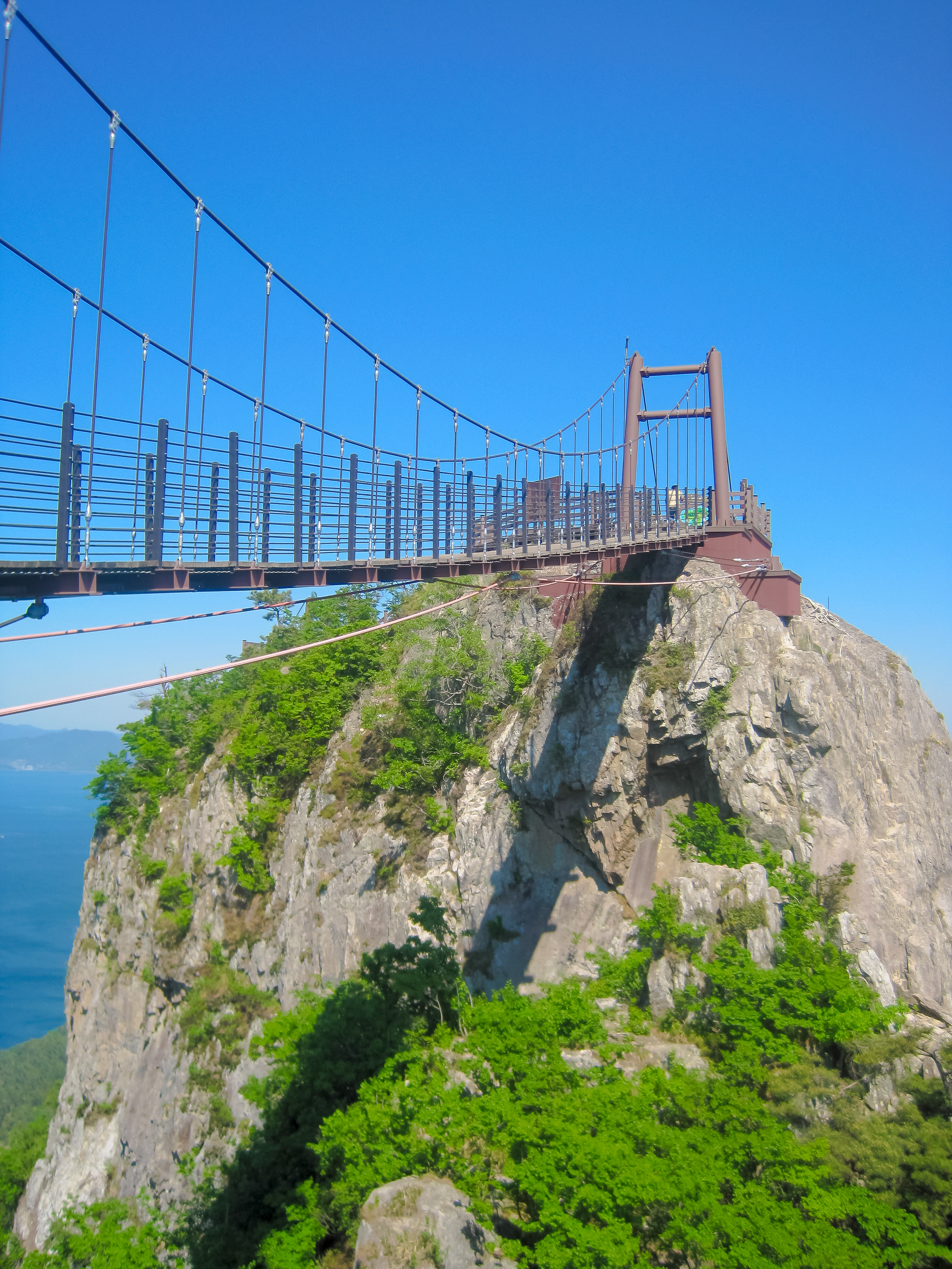
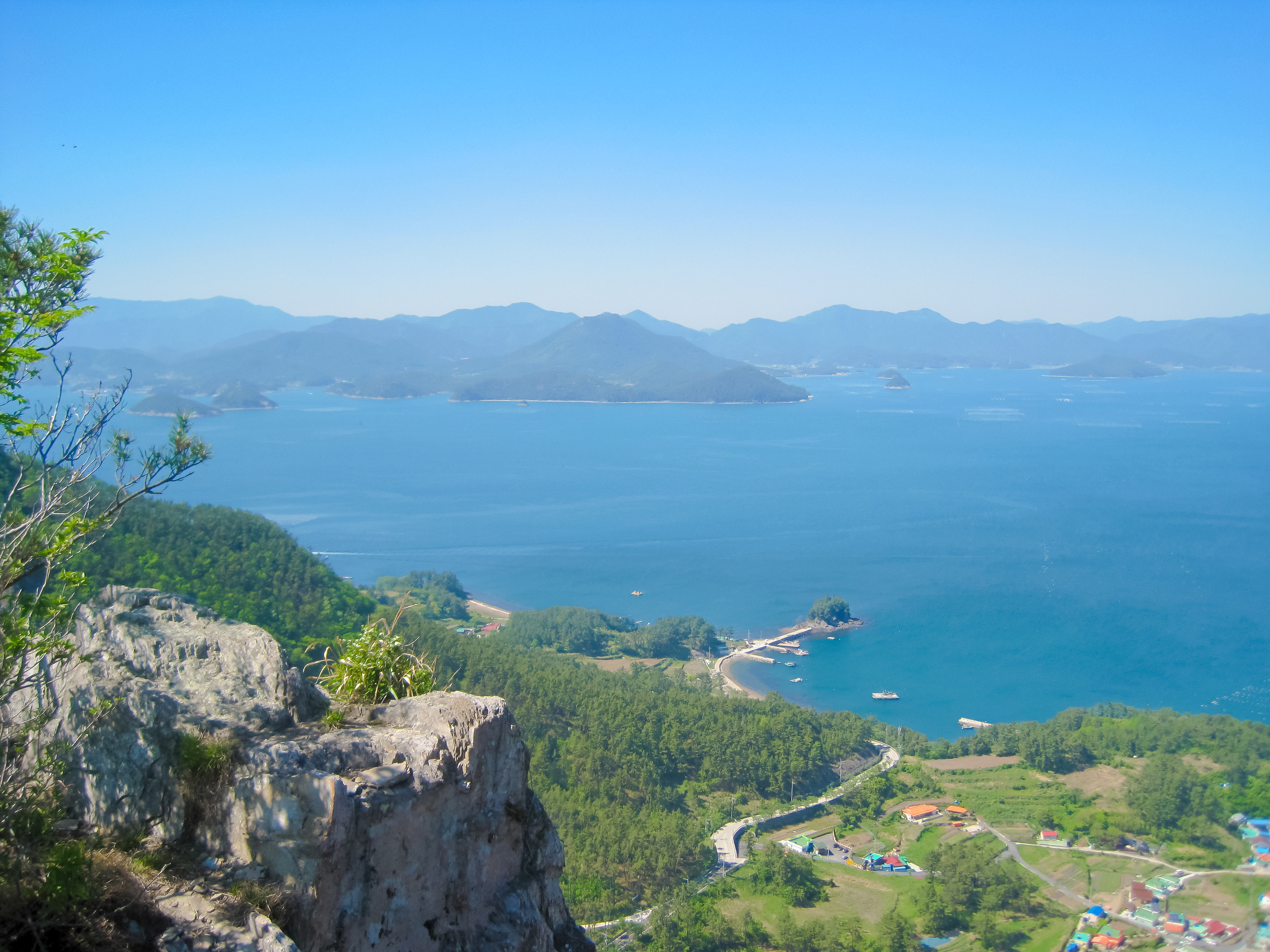
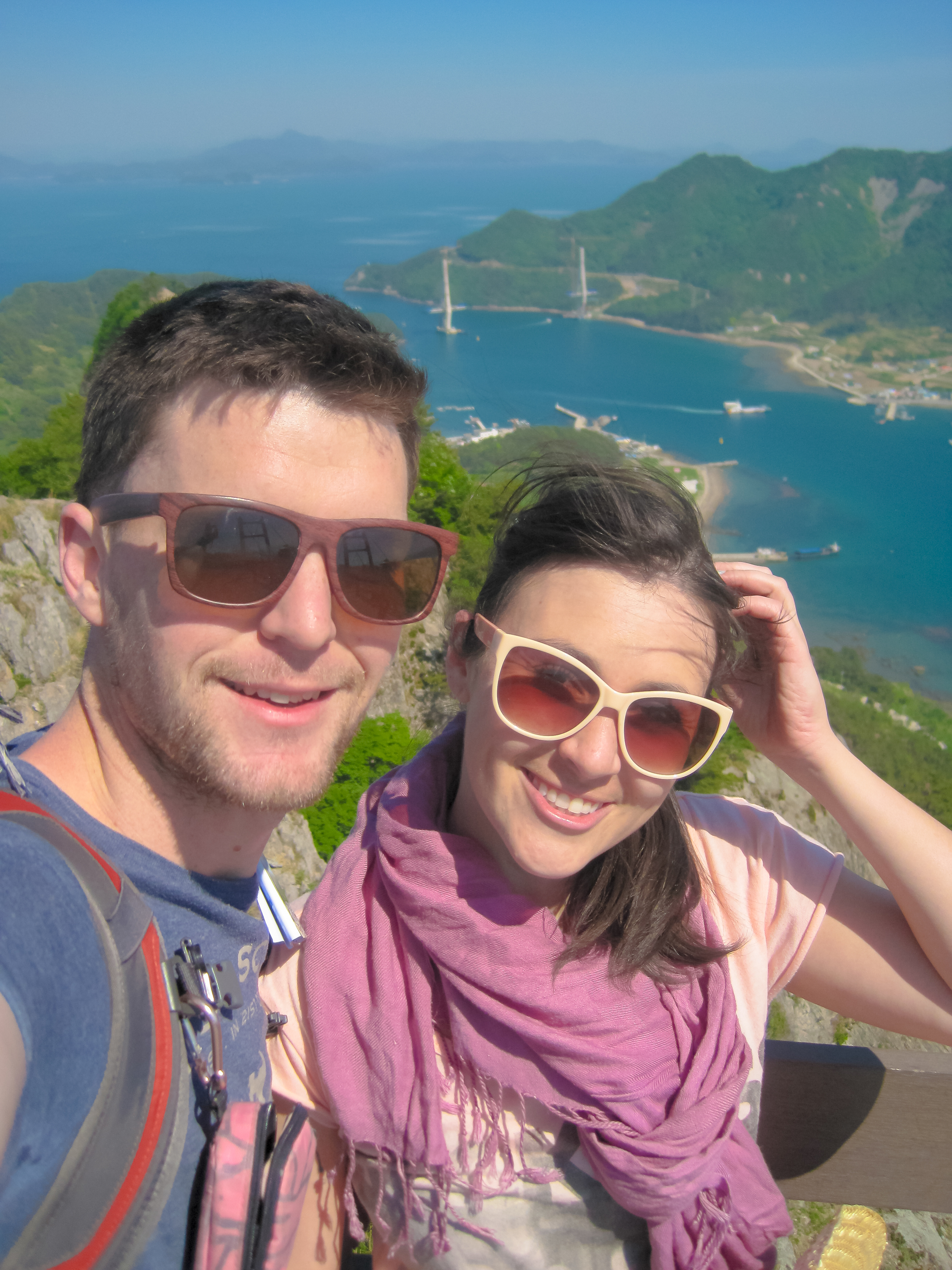
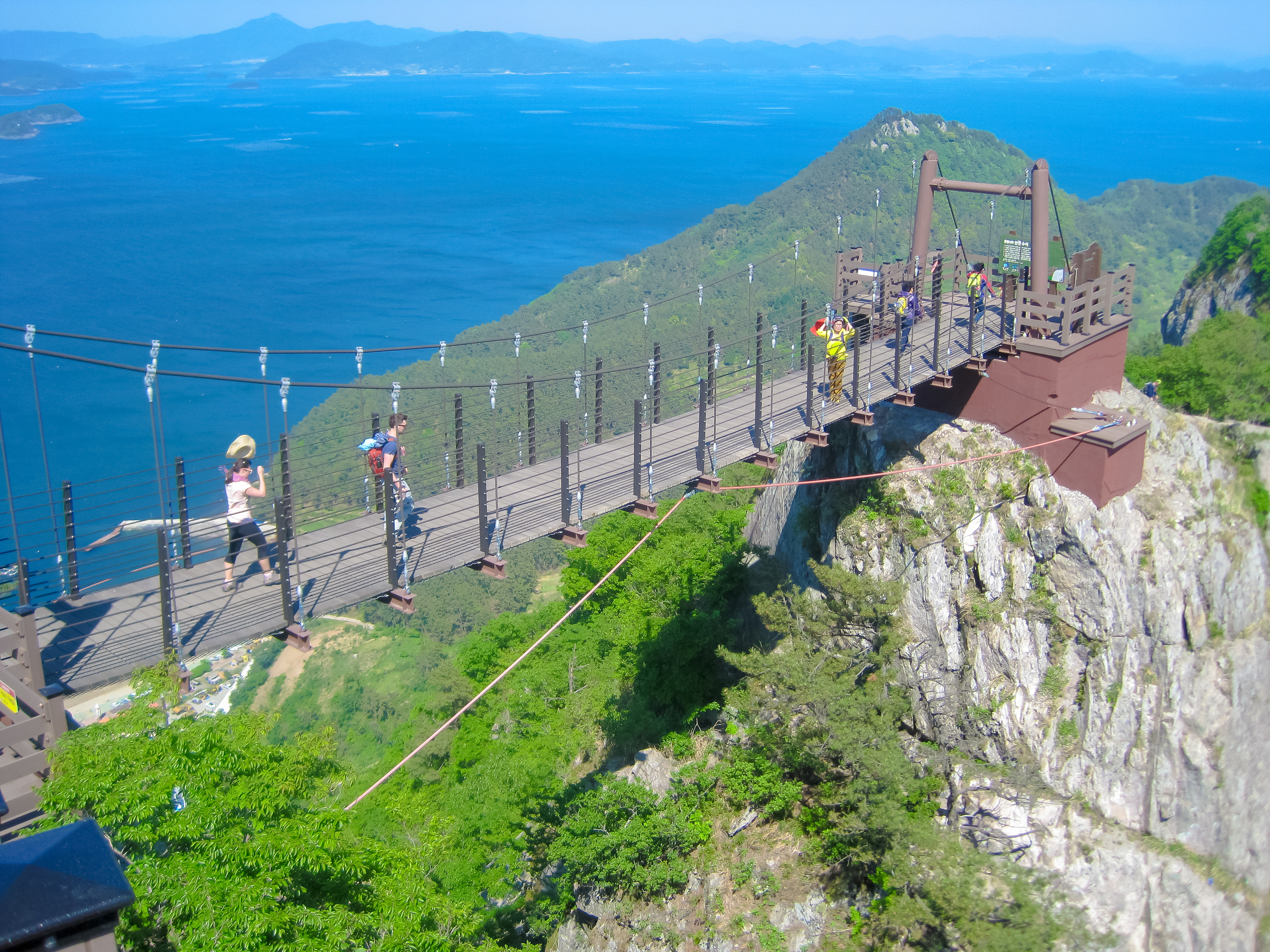
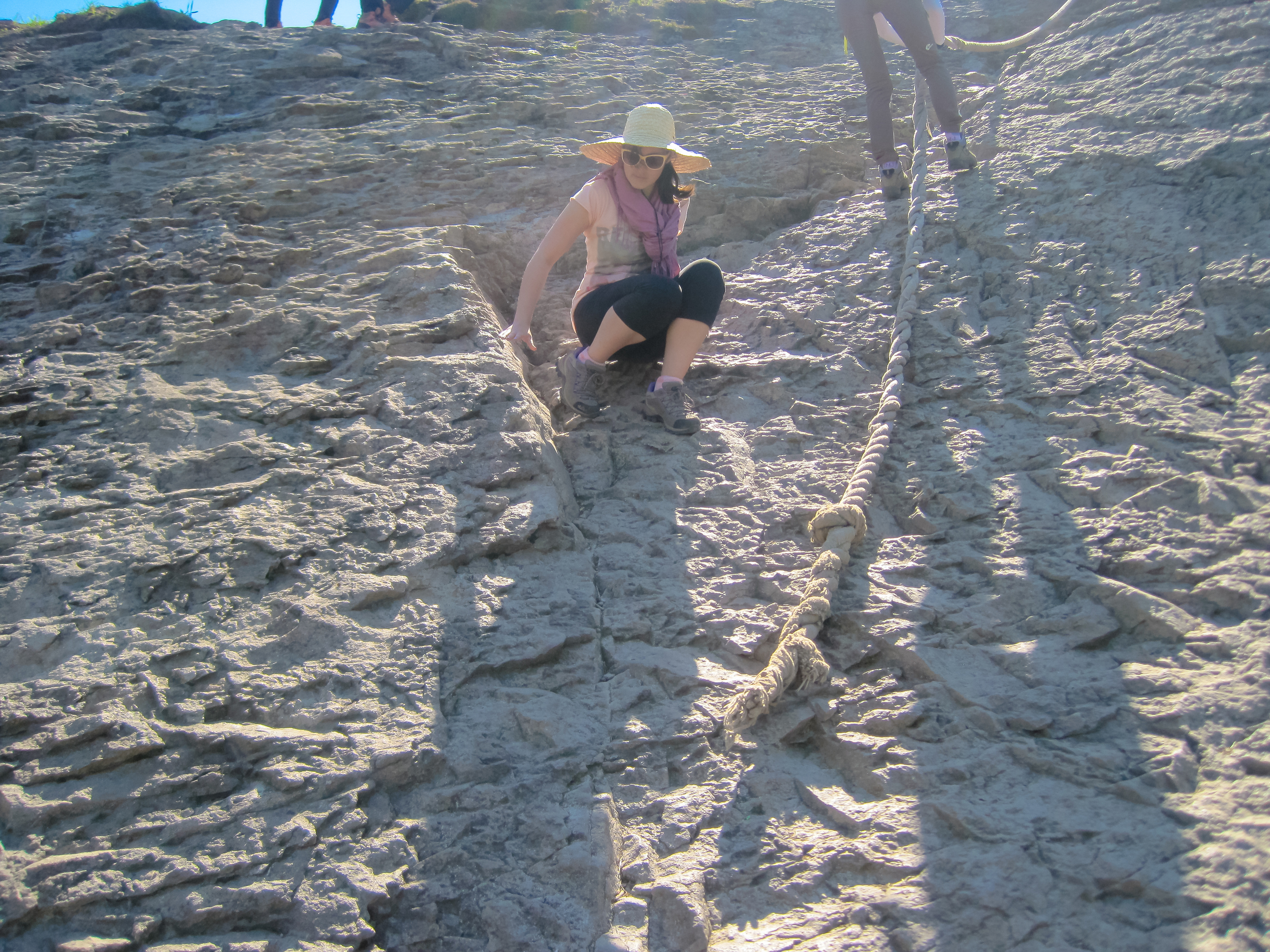
The hike itself wasn't particularly challenging, but there were some very steep parts where we all had to scramble on our bums, or hang on for dear life while descending stair cases. You are making your way across actual jagged cliff peaks so even though the distance doens't seem that much (about 7km from east to west) it is pretty slow going for most of the way. It was a good 4 -5 hour hike but the views from the top were incredible.
We were also very lucky with the weather, and had clear blue skies the entire way.
The hike itself is designed to end at the ferry terminal, so you have a few options. Either catch a shuttle bus (which may or may not be running at the time) to the main start of the hike, grab a taxi bus (we ended up doing this and it cost us W20 000 which we split between the 5 of us) or you can walk to the start which is a fairly long distance. You can also choose to do the hike backwards but I think the last thing you will want to be doing one you finish the hike will be walking along the main road to the terminal.
The shuttle bus leaves the harbour 7 times a day running around the island. In the morning it runs clockwise at 6:50am, 7:45, 9:45 and 11:45. In the afternoon it goes counter-clockwise at 1:45, 3:45 and 5:35. The afternoon buses leave Donji at the far west of the island, bound for the harbour at 2:10, 4:10 and 6:10.
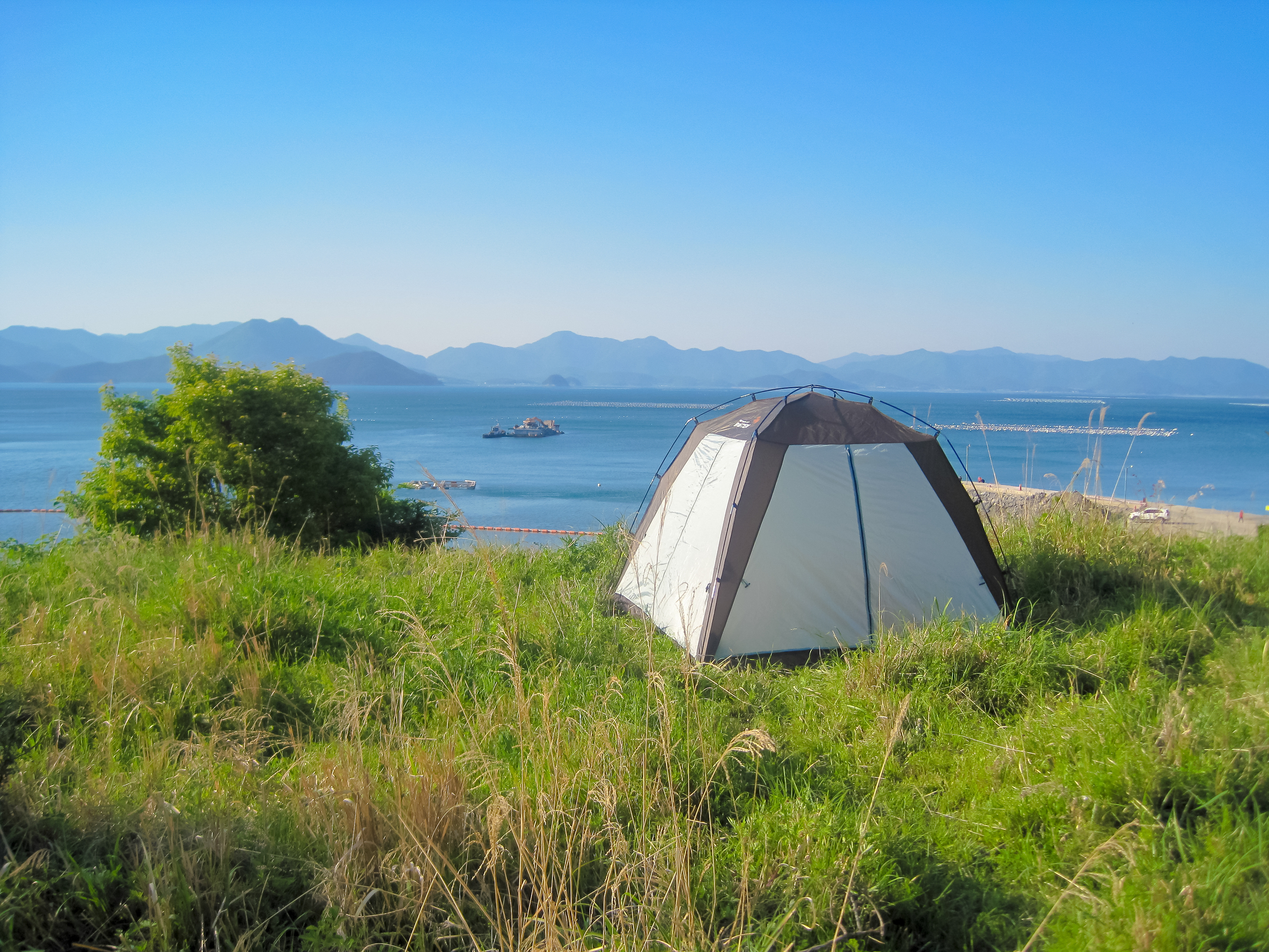
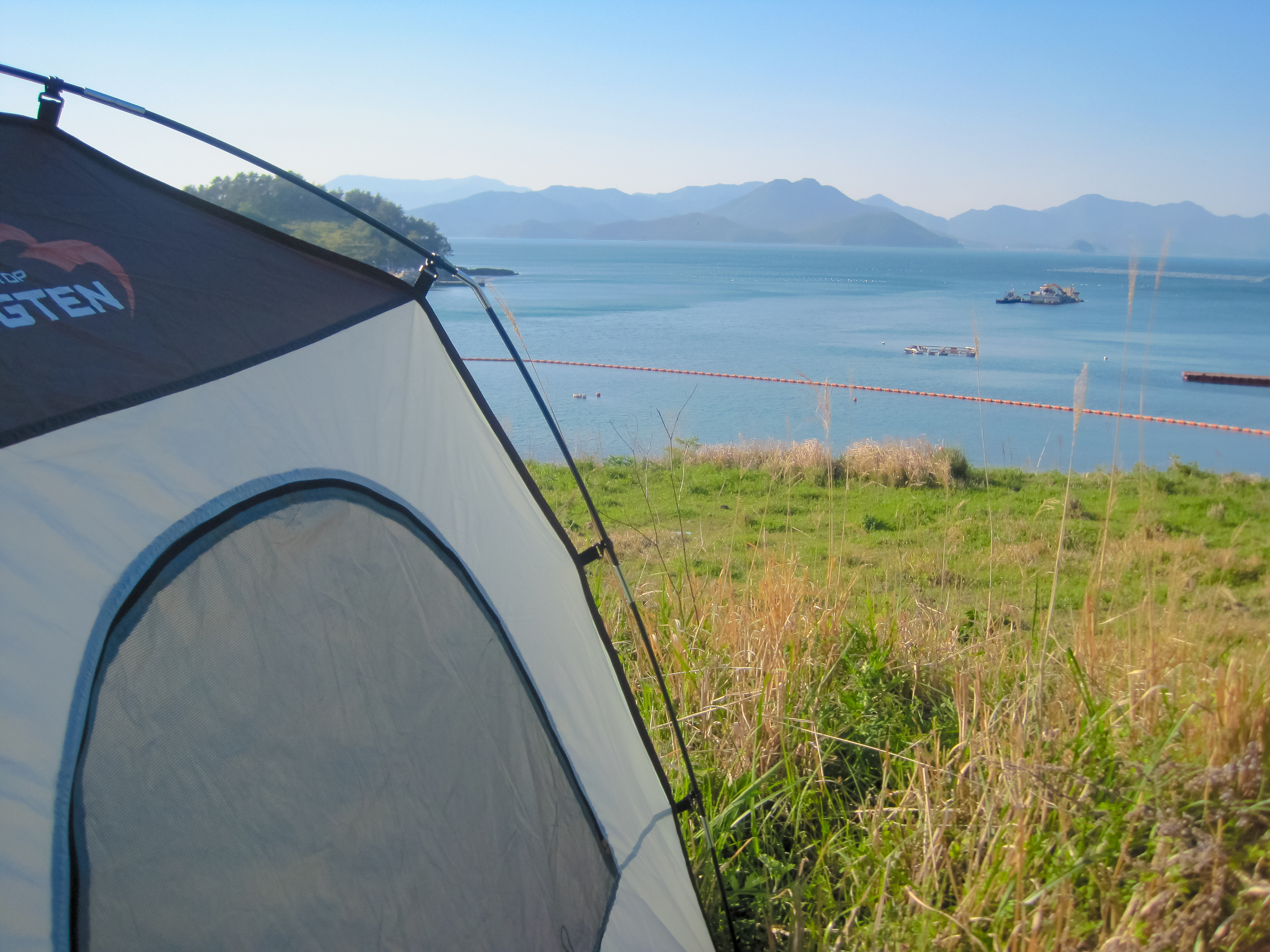
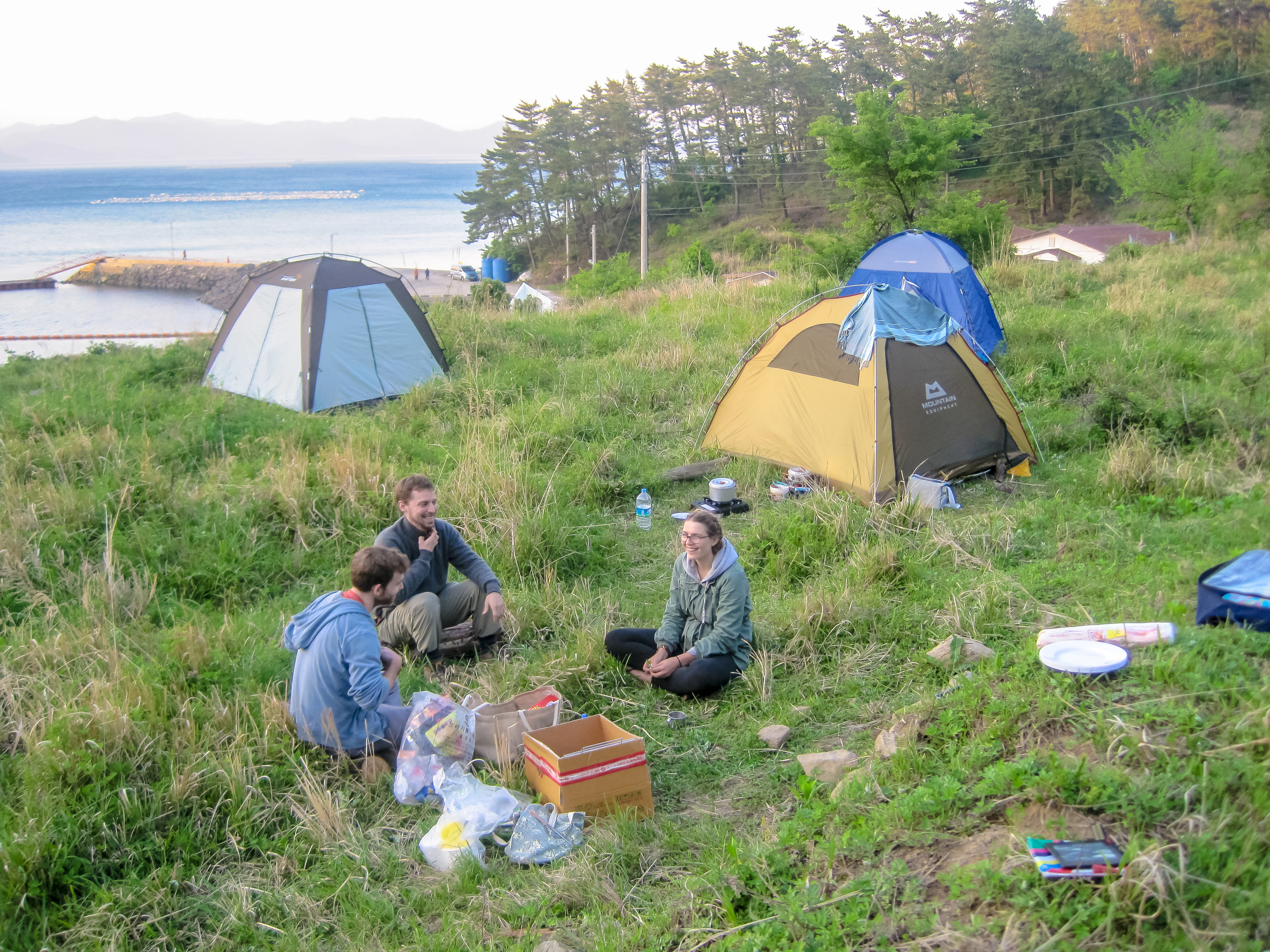
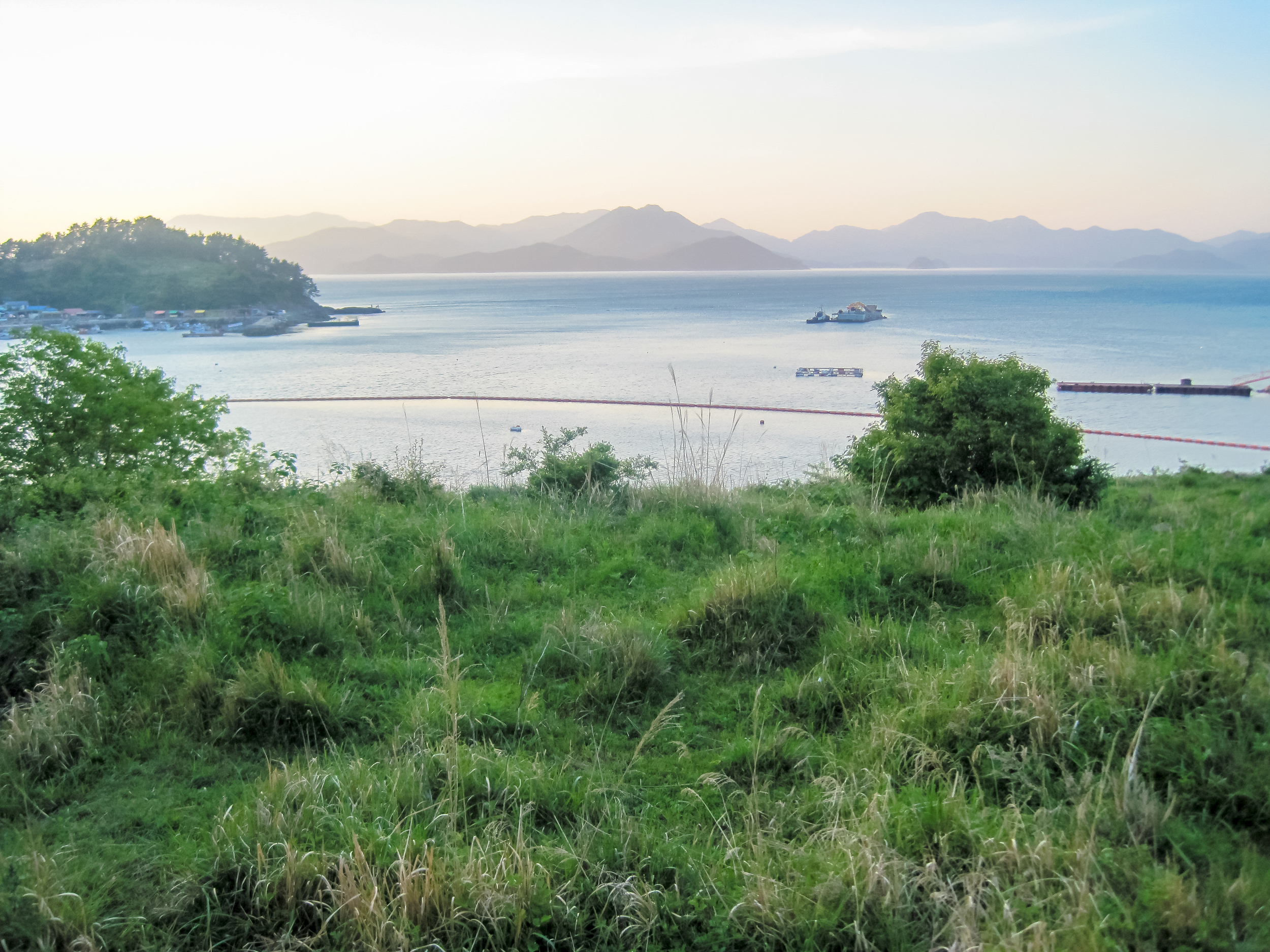
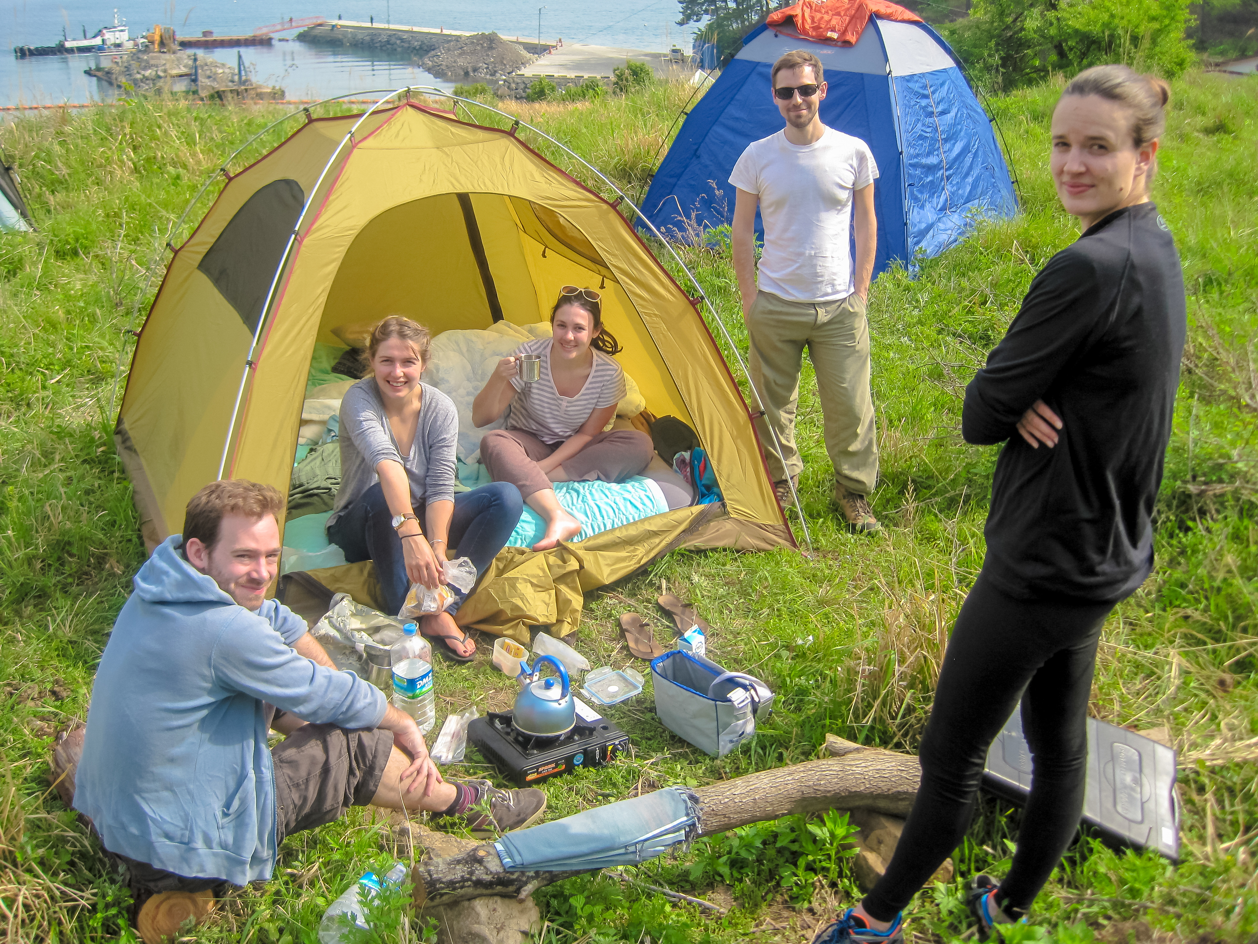
We had packed camping gear and made our way to a quiet beach area. The Korean families were all jam-packed in the car park, as they tend do do (Korean style camping is VERY different from South African style camping). We managed to scramble up a small hill behind the main campsite onto a patch of land (it seemed to be private but the owner didn't bother us and we made sure to clean up everything after our stay) and had the most amazing views from the doors of our tents.
It was one of the best hikes I've done in Korea so far!